
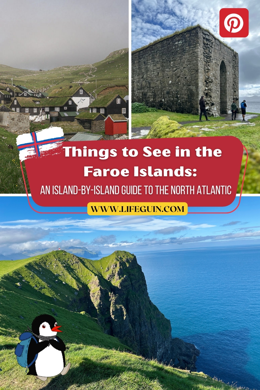
Discover what to see and do in the Faroe Islands with this complete travel guide
After spending one unforgettable week in the Faroe Islands, we managed to explore a remarkable mix of cliffs, villages, and hidden corners that reveal the spirit of this North Atlantic archipelago. Every day brought something new, whether it was hiking to a lighthouse at the edge of the world, wandering through turf-roofed lanes in Tórshavn, or watching puffins swoop across the sea. We quickly learned that each island has its own rhythm and story, and together they form a journey unlike anywhere else. Here is what we recommend seeing island-by-island when visiting the Faroe Islands.
Vágar Island: Gateways and Waterfalls
Most of you will first land on Vágar, where the international airport sits near Sørvágur. But the island offers far more than an arrival point.
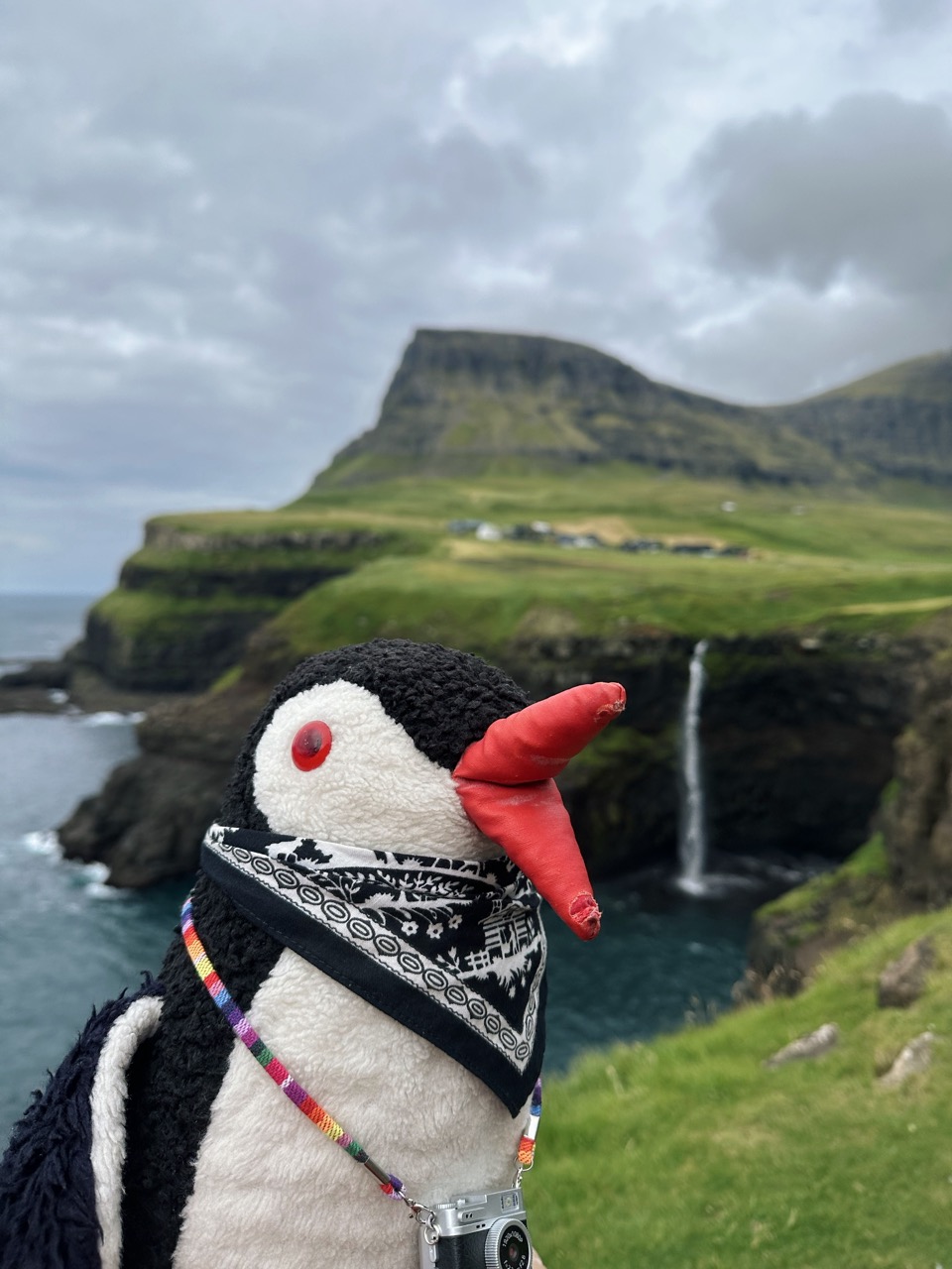
- Múlafossur waterfall plunges straight into the Atlantic Ocean. The village, once remote, is now connected by a tunnel but still feels like the end of the road.
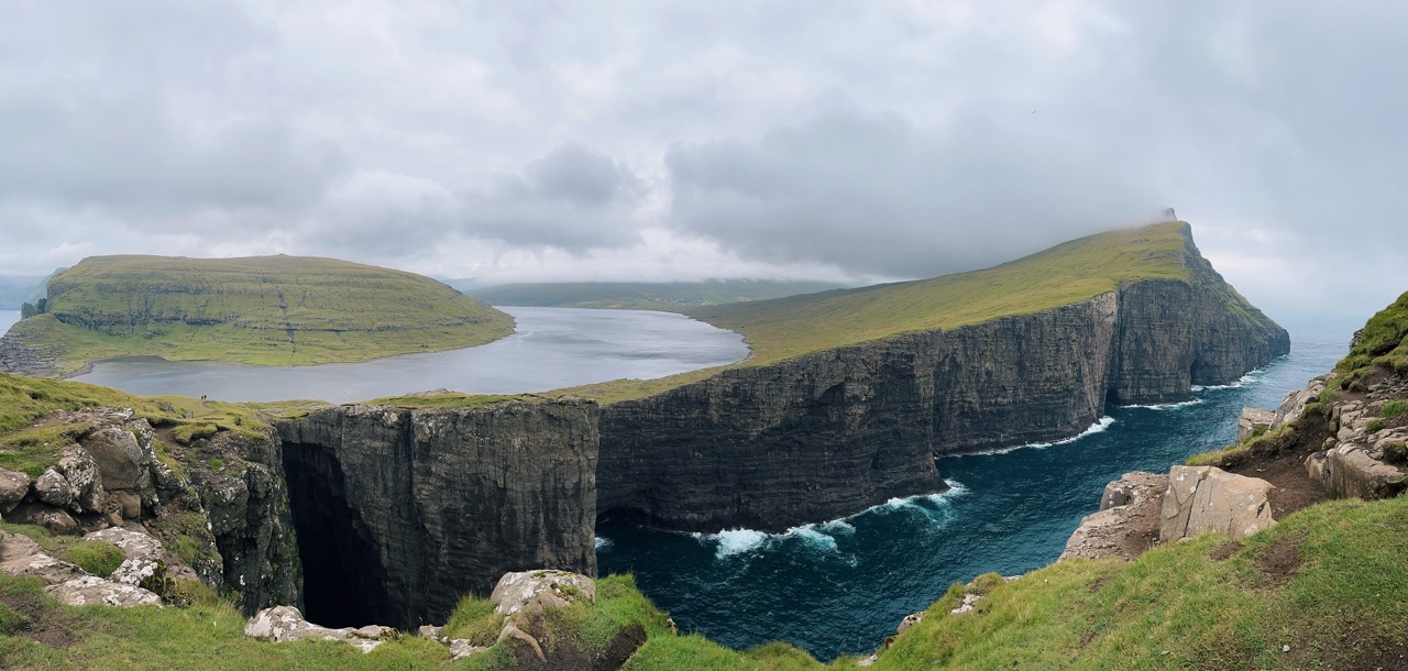
- Lake Sørvágsvatn. Known as “the lake above the ocean.” The hike to Trælanípa cliff creates the illusion that the lake floats high above the sea.
- From the same trail, you see the dramatic Bøsdalafossur waterfall.
- Vatnsdalsvatn. A smaller but beautiful lake near Sandavágur, often overlooked because Sørvágsvatn steals the show. It’s a peaceful spot for a short waddle.
- Bøsdalafossur. A powerful waterfall that carries the waters of Sørvágsvatn directly into the Atlantic, surrounded by rugged cliffs and ocean spray.
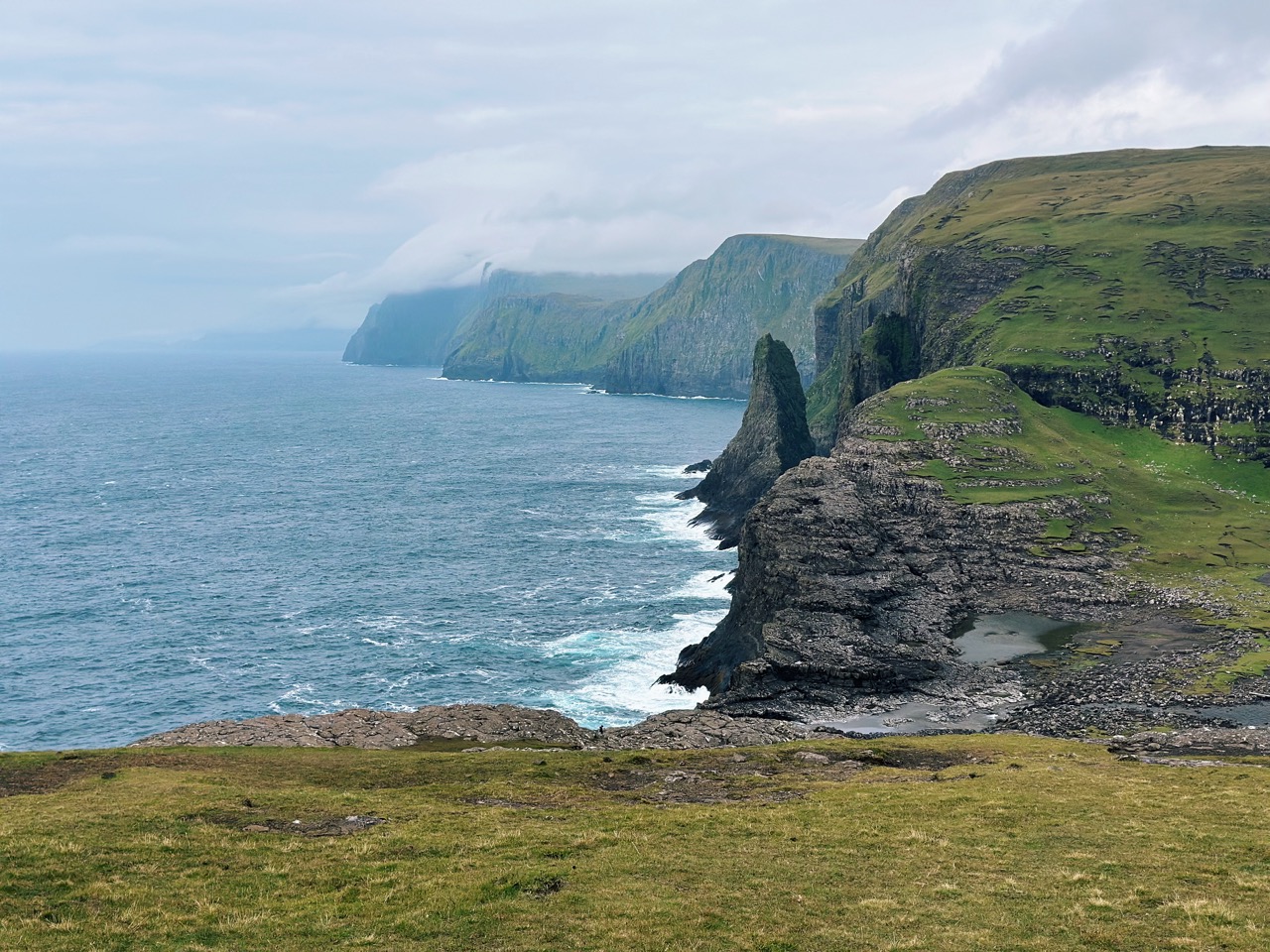
- Boat trip to Drangarnir. A journey to the iconic sea arches that rise like natural gateways from the water, with views of the jagged Tindhólmur islet close by.
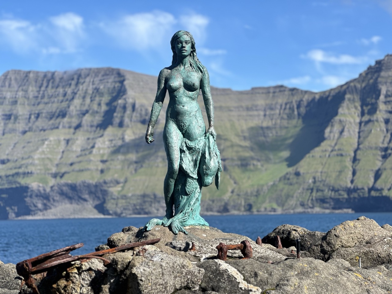
- Nix Statue. A modern sculpture in Sandavágur is inspired by the legend of the Nix, a water spirit from Faroese folklore that lured people to the sea.
- Trøllkonufingur Viewpoint. A dramatic viewpoint south of Sandavágur with panoramic views of the sea stack known as “The Witch’s Finger,” a tall rock spire rising from the ocean. Legend says it is the finger of a giant witch turned to stone.
- Bøur. A small settlement west of Sørvágur with turf-roofed houses and sweeping views across the fjord toward Tindhólmur and Drangarnir.
- Tindhólmur. A striking uninhabited islet off the coast of Vágar, famous for its five sharp peaks that resemble dragon spines. It is best admired on boat trips or from viewpoints near Sørvágur, especially at sunset when the ridges glow against the Atlantic.
- Sandavágur Church. A striking red-roofed church overlooking the fjord. Inside, you find a Viking runestone that carries one of the oldest written names in Faroese history.
- Munkastova Cave. A sea cave near Sørvágsvatn, once used as a hiding place by monks. Accessible by boat, it combines dramatic rock formations with echoes of history and legend.
- Fjallavatn Lake. The second-largest lake in the Faroes is in the northwest of Vágar. It feels remote and wild, with a scenic hike along its shores.
- Árnafjall. The highest mountain on Vágar (722 m). A hike here gives wide views over Gásadalur, Tindhólmur, and the Atlantic horizon.
Streymoy Island: The Heart of the Faroes
Streymoy is the largest island and the hub of the Faroe Islands. Tórshavn, the capital, lies on its eastern coast.
- Tórshavn. The capital of the Faroes, with a colorful harbor, local cafés, and Tinganes, the old government quarter with turf-roofed houses.
- Kirkjubøur. The site is notable for its historical significance, featuring the ruins of St. Magnus Cathedral, the medieval Roykstovan farmhouse, and offering views across to the southern islands.
- Saksun. A dramatic village set in a natural amphitheater with a tidal lagoon. At low tide, you walk along the sand toward the ocean.
- Tjørnuvík. A black-sand beach framed by mountains with views of the sea stacks Risin og Kellingin. Known for surfing and Viking burial finds.
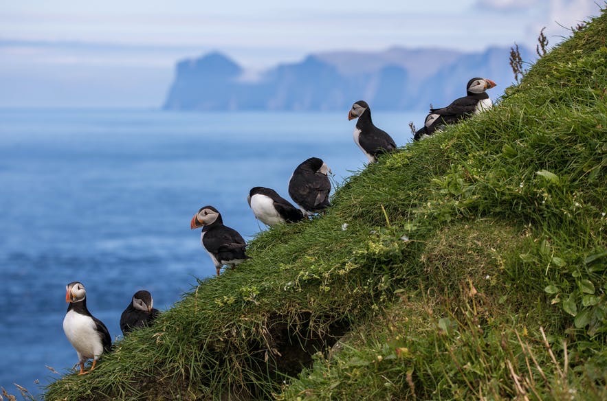
- Vestmanna Bird Cliffs. Steep coastal cliffs reached by boat tours. Famous for puffins, fulmars, and caves carved by the Atlantic.
- Hvítanes. A small village near Tórshavn with a harbor where pilot whales were once hunted. Known today for its sea views.
- Kvívík (Viewpoint over Kvívík). One of the oldest settlements in the Faroes. Archaeological remains of Viking longhouses stand by the river.
- Leynar Beach. A sandy beach on the west coast is popular for swimming and summer picnics. Surrounded by mountains with wide views of the Atlantic.
- Hvalvík and Norðradalur. Quiet villages that reflect everyday Faroese life. Known for wooden churches and fjord views.
- Hiking above Haldórsvík. Trails that lead to viewpoints over the north coast of Streymoy with vistas of sea stacks and nearby islands.
- Fossá Waterfall. The tallest waterfall in the Faroe Islands has a two-tier drop of 140 meters. Located near Haldórsvík, it cascades down the cliffs into the sea and can be seen from the road or reached by a short hike.


- Miðdepil Føroya. A stone monument near the village of Syðradalur on Streymoy marks the geographical center of the Faroe Islands. A symbolic spot that highlights the heart of the archipelago.
- Sornfelli Mountain. A mountain plateau west of Tórshavn at 725 meters. Once a NATO radar station, it now offers panoramic views over Streymoy, Vágar, and Eysturoy, especially at sunset.
- Kluftáfossur Waterfall. A hidden waterfall near Kollafjørður on Streymoy. The river Kluftá tumbles down rocky steps into the valley, surrounded by quiet scenery and grazing sheep.
- Haldórsvík Church. The only octagonal church in the Faroe Islands, dating from 1837. Its unique shape and wooden interior make it stand out.
Eysturoy Islands: Peaks, Villages, and Bridges
Eysturoy, the second largest island in the Faroes, feels like a bridge between past and present. A causeway and the new subsea tunnel connect it to Streymoy, but once you arrive, the pace slows and the scenery shifts. Deep fjords carve into the land, fishing villages cling to the shores, and peaks rise sharply toward the sky.
- Eysturoyartunnilin. The new subsea tunnel linking Eysturoy to Streymoy. It is known for its underwater light installation and is considered a modern Faroese landmark.
- Gjógv. A picturesque village on the northern tip of Eysturoy. Known for its natural sea-filled gorge that once served as a harbor and for wide views across to Kalsoy.
- Hvithamar Viewpoint. A dramatic viewpoint near Gjógv. From the cliff edge, you look out over Funningsfjørður and the surrounding peaks, one of the most photographed panoramas in the Faroes.
- Oyndarfjørður. A small village known for the Rinkusteinar, two rocking stones in the sea that move with the waves and carry local legends.
- Funningur. Believed to be the first Viking settlement in the Faroes. The village lies at the mouth of a fjord surrounded by steep mountains.
- Slættaratindur. The highest mountain in the Faroe Islands is at 880 meters. A hike to the summit rewards you with sweeping views across the entire archipelago on a clear day.
- Eiði. A village at the northern end of the island. Famous for its scenic football pitch by the sea and for views of the sea stacks Risin og Kellingin.
- Eiðiskollur. A dramatic headland near the village of Eiði. Known for panoramic views across to the sea stacks Risin og Kellingin and the northern coastline of Streymoy.
- Risin og Kellingin. Two towering sea stacks off the coast near Eiði. Known as “The Giant and the Witch,” they are tied to a legend of giants trying to drag the Faroe Islands to Iceland.
- Gorge Elduvík. A narrow gorge that cuts through the cliffs beside the village. Waves rush into the channel, creating dramatic sound and movement against the rocks.
- Runavík. A harbor town and one of the leading commercial centers on the island. Known for shopping, restaurants, and easy access to nearby hikes.
- Skálafjørður fjord. The longest fjord in the Faroe Islands. Villages along its shores offer calm scenery and reflections of mountains in the water.
Kalsoy Island: Lighthouses and Legends
Kalsoy is a long, narrow island known for its lighthouses and legends. Reaching it means taking a ferry from Klaksvík and driving through a series of single-lane tunnels. The island feels like a journey into stories.
- Kallur Lighthouse. The most famous sight on Kalsoy. A hike across ridges leads to the lighthouse at the island’s northern tip, with dramatic views over the sea and neighboring islands.
- Mikladalur. A village known for the statue of the Seal Woman, a legendary figure from Faroese folklore. The cliffs here are impressive, and the story adds depth to the landscape.
- The Seal Woman Statue. A bronze sculpture in Mikladalur that honors the Faroese legend of a seal who shed her skin to become human. The story tells of love, captivity, and her eventual return to the sea.
- James Bond Headstone. A stone memorial near Kallur Lighthouse marks the dramatic final scene of No Time to Die. Fans visit the stand where James Bond made his last stand against the Atlantic backdrop.
- Trøllanes. The northernmost village on Kalsoy. Remote and quiet, surrounded by mountains, and the starting point for the hike to Kallur Lighthouse.
- Syðradalur. The southern ferry terminal village is where you will arrive. From here, a single road and a series of narrow tunnels connect the other settlements.
- Single-lane tunnels. Driving on Kalsoy is an adventure in itself. A string of dark, single-lane tunnels links the villages, creating a memorable experience.
Borðoy Island: Klaksvík and Beyond
Borðoy is the largest of the Northern Isles and home to Klaksvík, the second city of the Faroes. This fishing port has museums, breweries, and a cultural life that shows another side of Faroese society.
- Klaksvík. The second-largest town in the Faroes and the hub of the Northern Isles. It is known for its fishing industry, local breweries, shops, and cultural events.
- Klakkur Mountain. A short hike from Klaksvík that rewards you with views over the town, surrounding fjords, and across to Kalsoy.
- Christianskirkjan. A modern church in Klaksvík built in 1963. Notable for its large glass windows, Nordic design, and a painting of Christ by the Faroese artist Joensen-Mikines.
- Svartidalurfoss. A striking waterfall near Klaksvík that cascades down the cliffs into a deep valley. Best viewed from the road, especially after rainfall when the flow is strongest.
Viðoy Island: The Northernmost Edge
Viðoy marks the northernmost point of the Faroes.
- Viðareiði. The northernmost village in the Faroe Islands. Set in a valley between mountains with sweeping views of the sea and nearby islands.
- Cape Enniberg. The highest sea cliff in Europe is at 754 meters. A challenging hike from Viðareiði leads to the cliff edge overlooking the Atlantic.
- Villingadalsfjall. One of the tallest mountains in the Faroes at 841 meters. The hike starts from Viðareiði and offers wide panoramas across the Northern Isles.
- Haraldssund Causeway. The link between Viðoy and Kunoy. The drive across offers views of fjords and mountains.
- Viðareiði Viewpoint. A panoramic spot above the northernmost village in the Faroes. From here, you see Villingadalsfjall, Cape Enniberg, and sweeping views across the ocean and surrounding islands.
Smaller Islands: Mykines, Skúvoy, Nólsoy, and Beyond
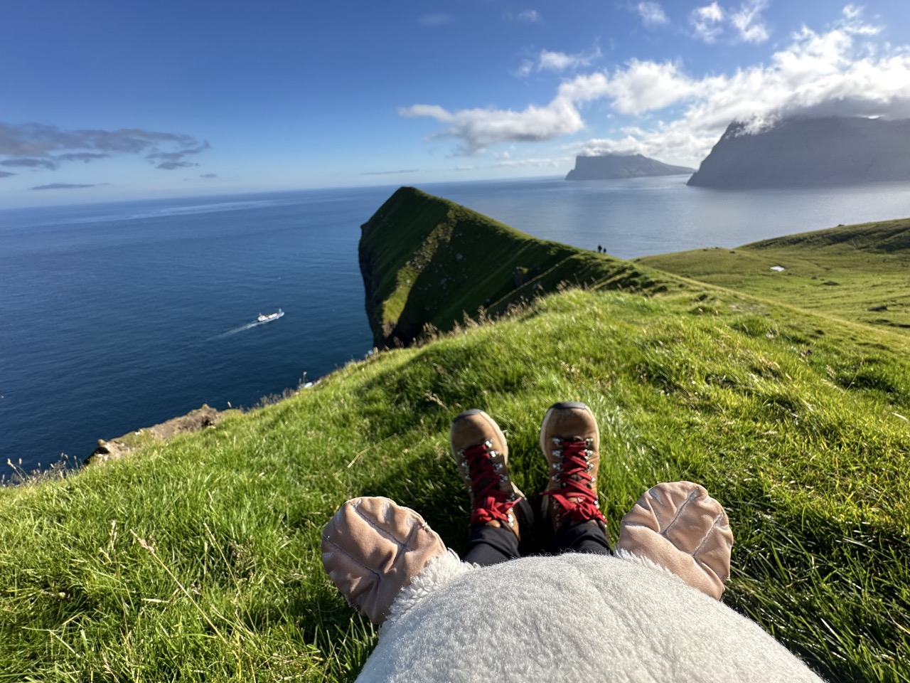
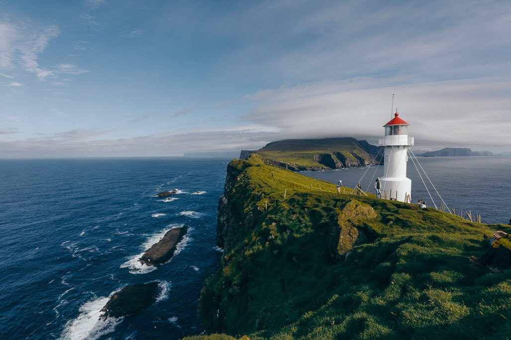
- Mykines is famous for puffins. A ferry from Sørvágur or a helicopter brings you to the island, where a hike to the lighthouse at Mykineshólmur crosses a narrow bridge above the sea. Puffins fill the cliffs, especially in summer, and the experience feels like stepping into a wildlife documentary.
- Skúvoy holds stories of Viking chieftains and battles. It remains quiet today, with hiking routes that offer both views and history.
- Nólsoy sits close to Tórshavn but feels like another world. The village has a community spirit, and hikes here lead to the ruins of a lighthouse and bird cliffs. Evening ferries bring you back to the capital after a day of exploration.
- Suðuroy, the southernmost island, feels distinct. Reaching it requires a ferry from Tórshavn, a two-hour journey that reveals dramatic cliffs as you approach.
- The island offers hikes with views of both the east and west coasts. Beinisvørð, a 469-meter cliff, gives panoramic views of the Atlantic. The village of Tvøroyri has a local museum, while Vágur has sports traditions, including an Olympic swimmer.
- Other small islands, some uninhabited, carry lighthouses, bird colonies, or fishing traditions. They add depth to the Faroese archipelago, showing how people live in balance with sea and land.
Planning Your Journey
- Traveling in the Faroe Islands means adapting to the weather and ferries.
- Distances look short on a map, but roads and conditions make each trip an adventure.
- Renting a car gives you freedom, while ferries and helicopters connect the islands that remain off the road network.
- Respecting nature is an integral part of traveling here.
- Trails cross fragile landscapes, and bird colonies depend on peace. Follow marked paths, carry out your waste, and embrace the Faroese rhythm of life.
- The Faroes never feel crowded, but they do feel alive. Each island offers something different, from cliffs to culture, from legends to lighthouses.
Looking back on our week, the Faroe Islands left us with a sense of wonder that lingers long after the trip ends. Each island carried its own character, some defined by sheer cliffs and roaring waterfalls, others by quiet fjords and legends that live on in stone and story. Traveling here means more than checking sights off a list; it means slowing down, embracing shifting weather, and letting the islands reveal themselves at their own pace. If you waddle through this archipelago with curiosity and respect, you’ll find that the Faroes don’t just offer places to see, they offer moments to remember.
Pack your bag and explore the Faroe Islands!
This post contains affiliate links. If you click and buy, I might earn a tiny commission, enough to help a penguin keep up its globe-trotting lifestyle. No extra cost to you, just more fish for me. Thank you for supporting the adventure!