
From sea-cliff cascades to hidden mountain streams, discover the most breathtaking waterfalls across the Faroes
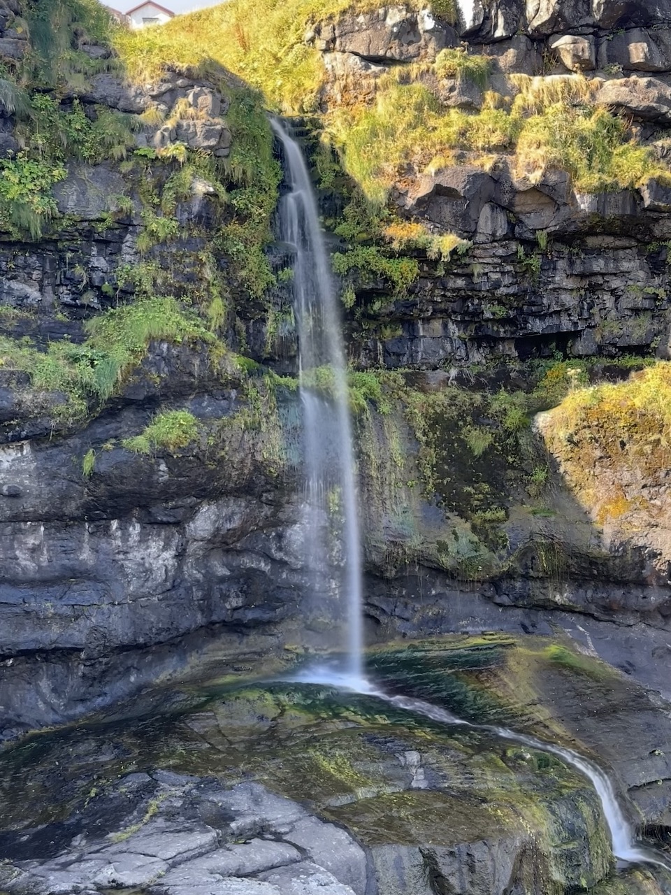
There is no shortage of waterfalls in the Faroe Islands. With over 40 named waterfalls across the 18 islands, you see water tumbling down cliffs, rushing through valleys, and even dropping straight into the Atlantic. Rainfall, mist, and streams shape the Faroese landscape every day, so wherever you travel, you are never far from a waterfall. Some, like Múlafossur in Gásadalur, appear on postcards and Instagram feeds worldwide. Others, such as Fossá, claim the title of the tallest waterfall in the Faroe Islands at 140 meters. One surprising fact: the islands receive so much rain that waterfalls often change shape and strength within hours, providing each visitor with a different view.
In this guide, you will find the waterfalls you should not miss during your trip, along with directions on how to reach them and practical tips to make the most of your visit.
- The Best Waterfalls to Visit in the Faroe Islands
- Fossá Waterfall
- Facts About Fossá Waterfall
- 🐧 Penguin Pro Tip
- Múlafossur Waterfall
- Facts About Múlafossur Waterfall
- 🐧 Penguin Pro Tip
- Bøsdalafossur Waterfall
- wFacts About Bøsdalafossur Waterfall
- 🐧 Penguin Pro Tip
- Hósvík Waterfall
- Facts About Hósvík Waterfall
- 🐧 Penguin Pro Tip
- Waterfalls Everywhere You Drive
The Best Waterfalls to Visit in the Faroe Islands
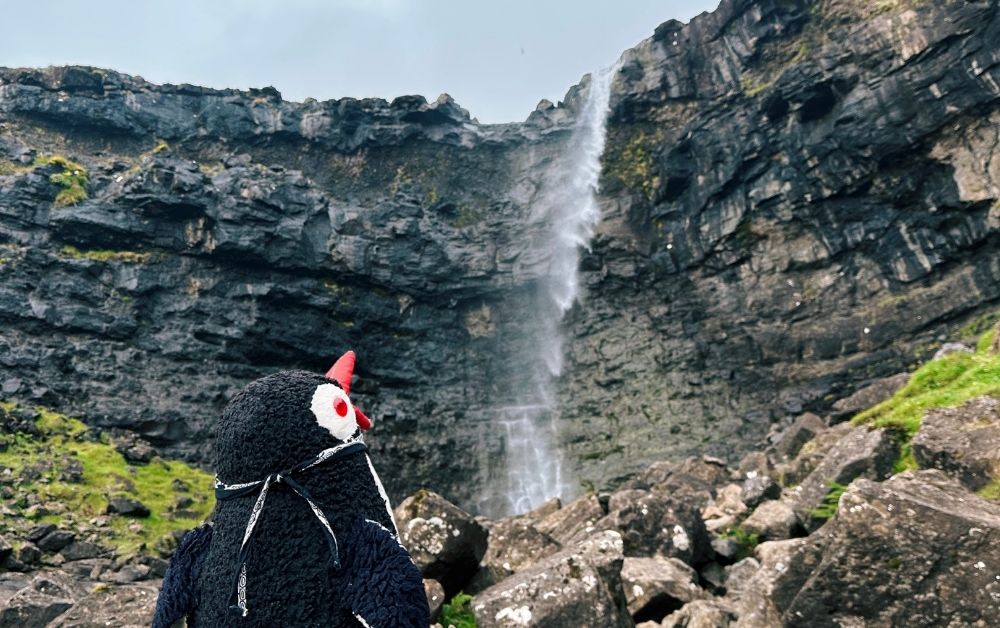
Fossá Waterfall
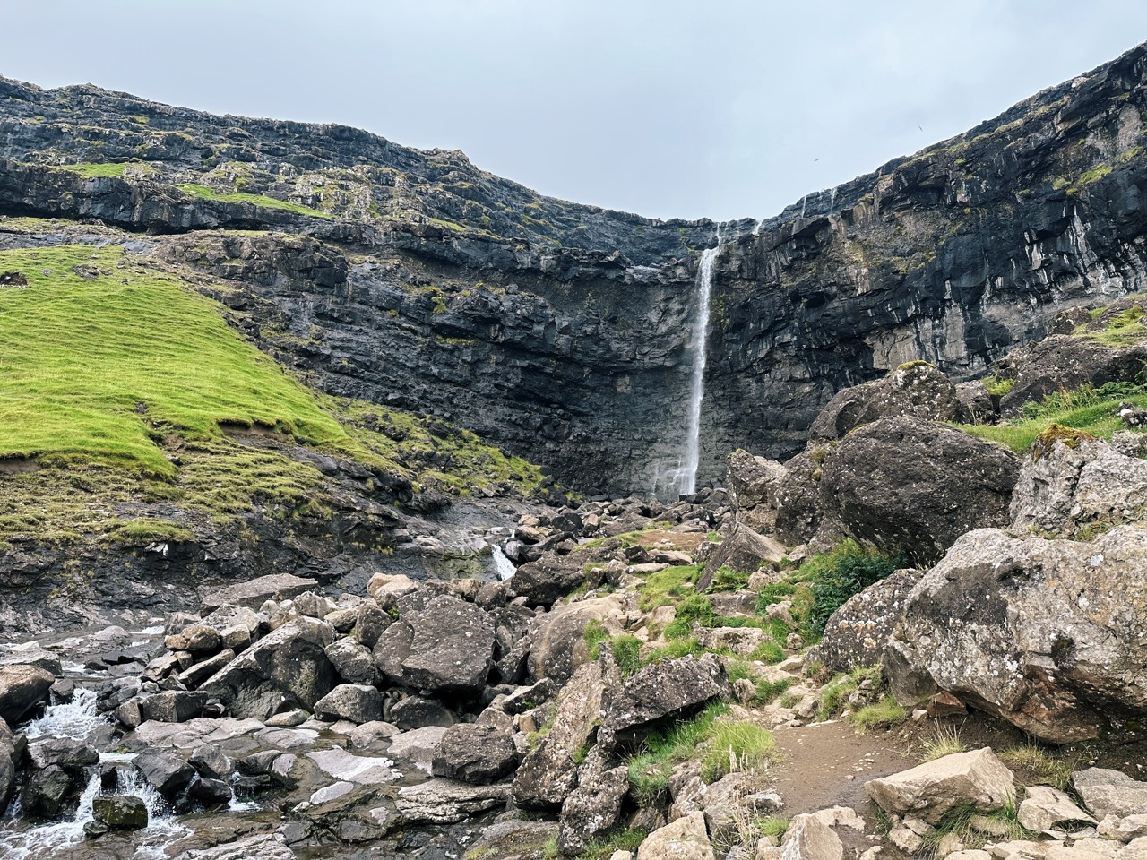
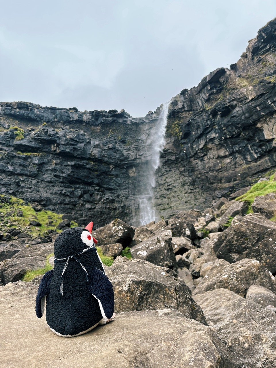
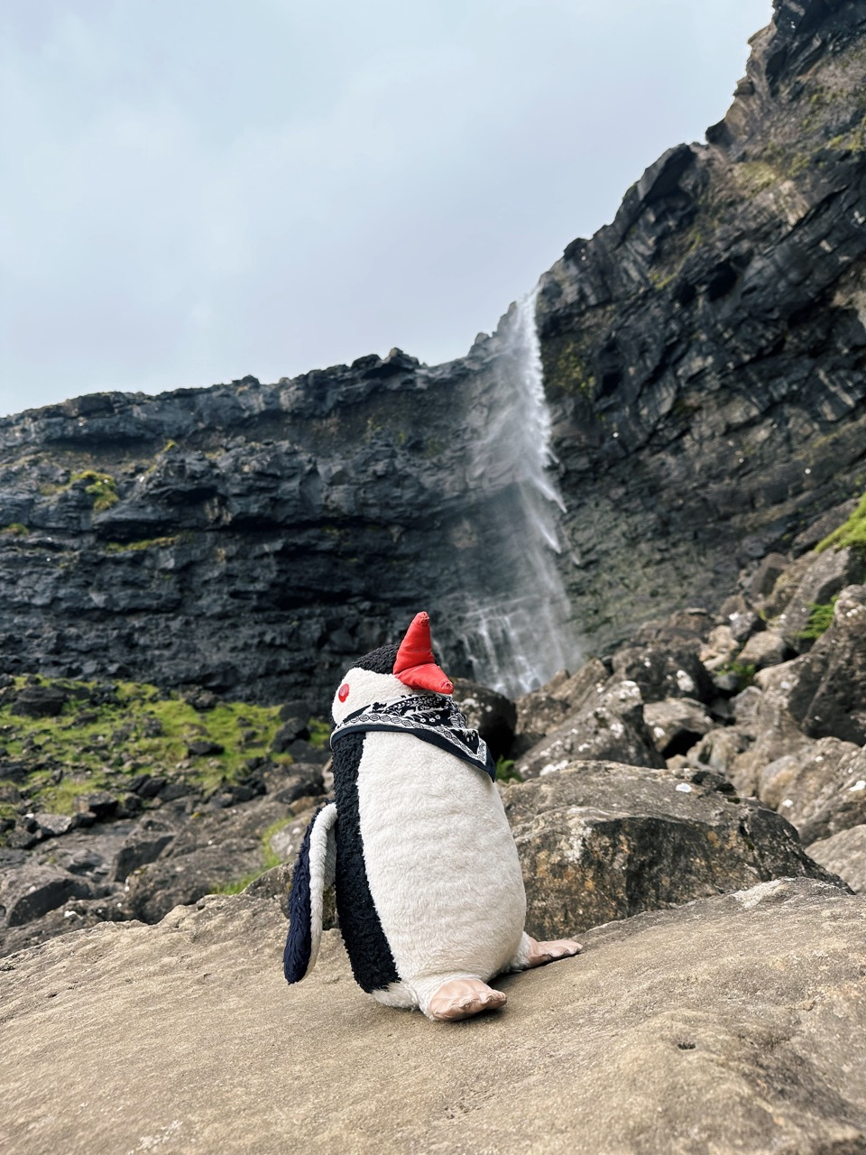
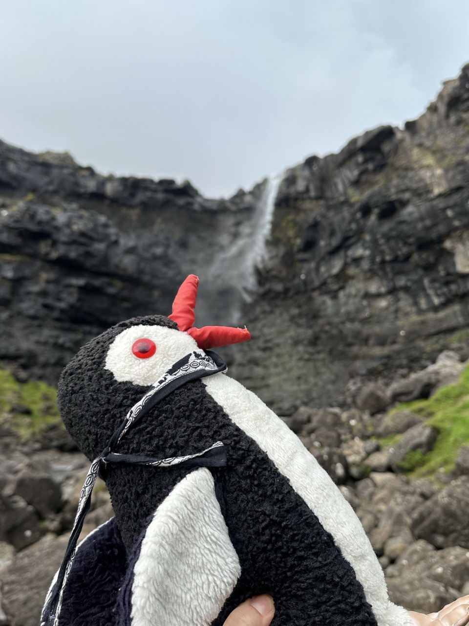
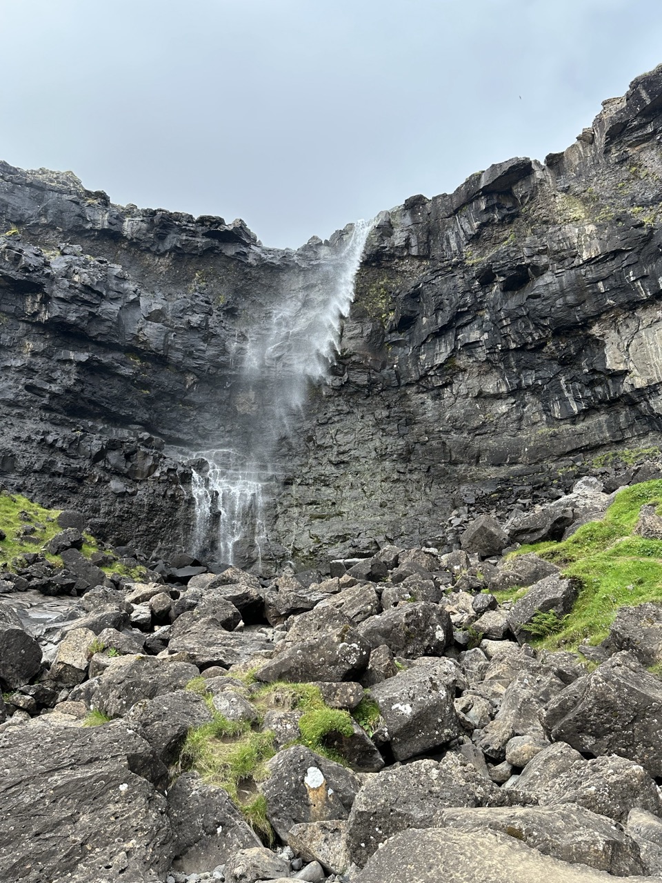
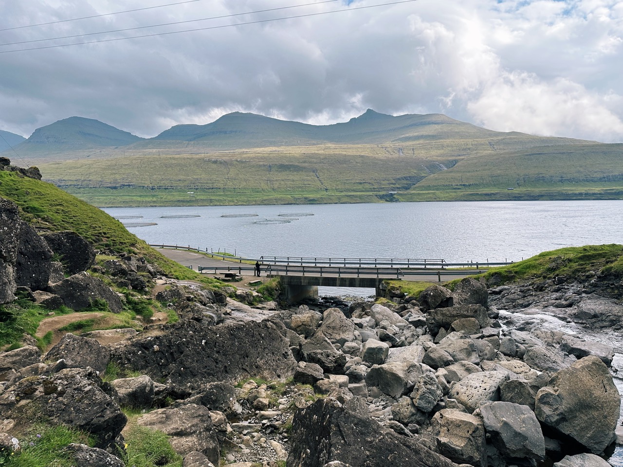
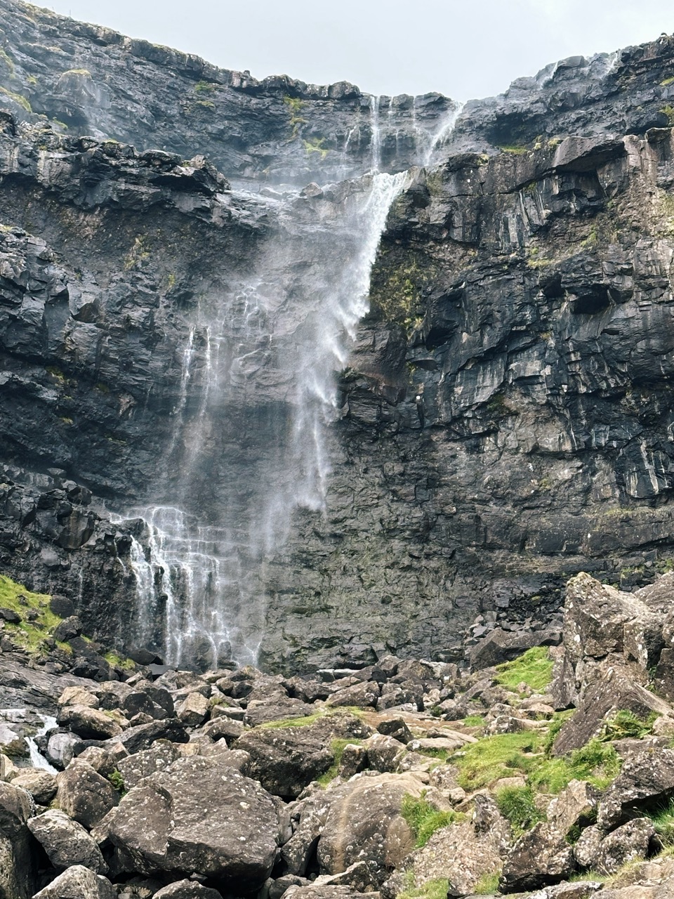
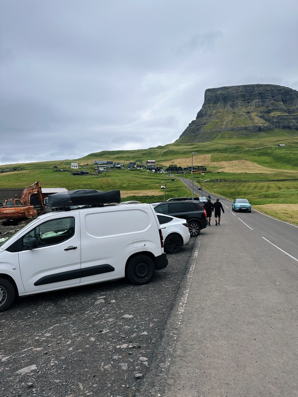
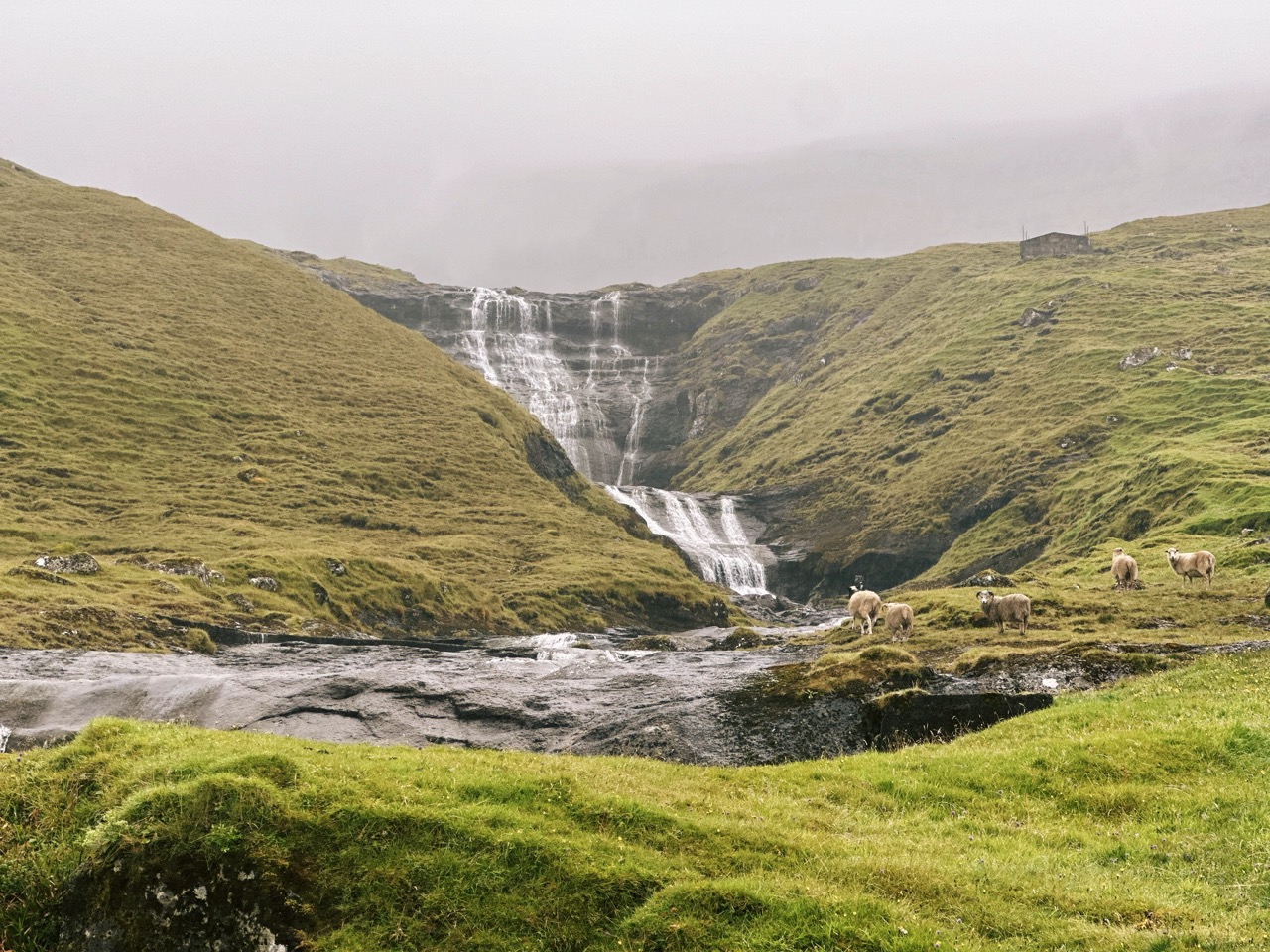
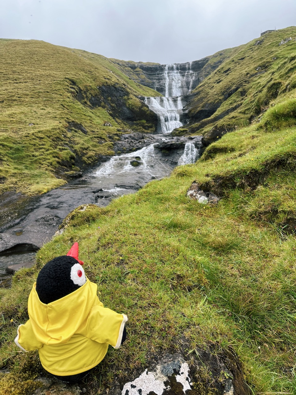
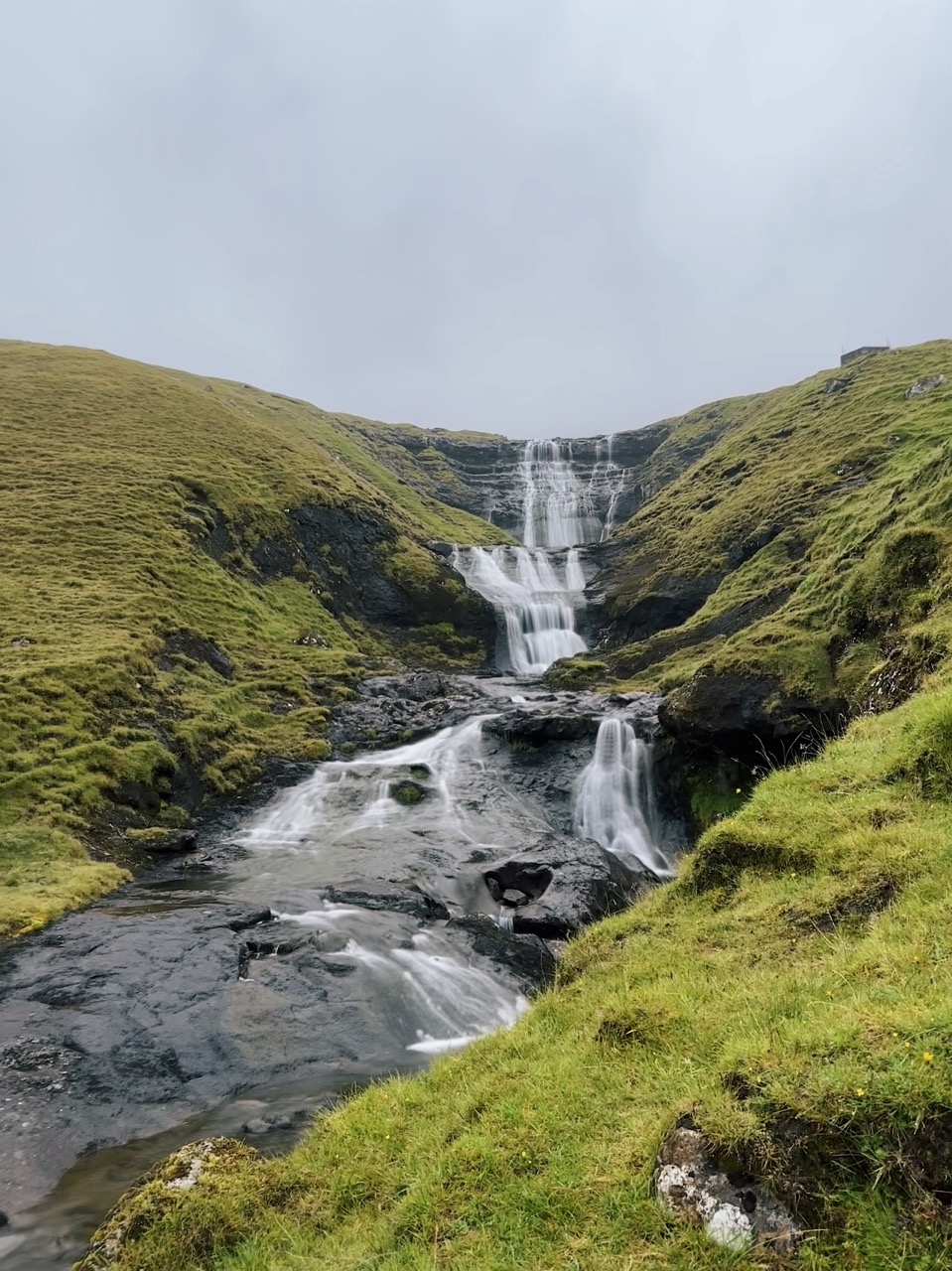
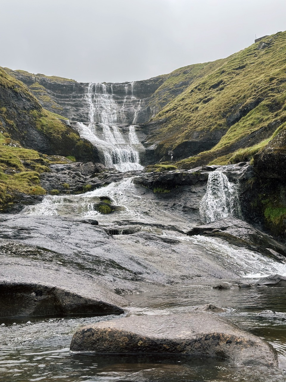
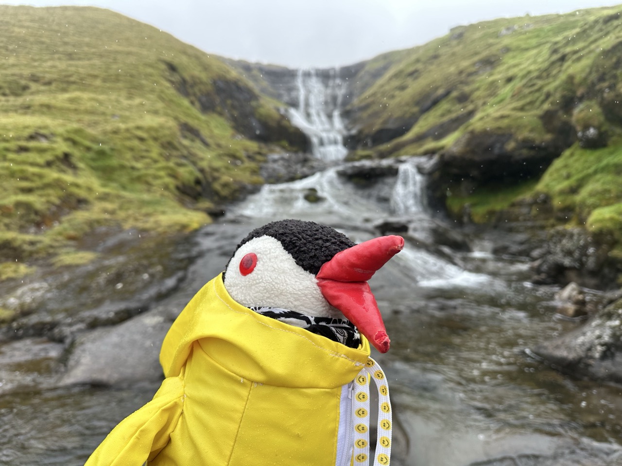
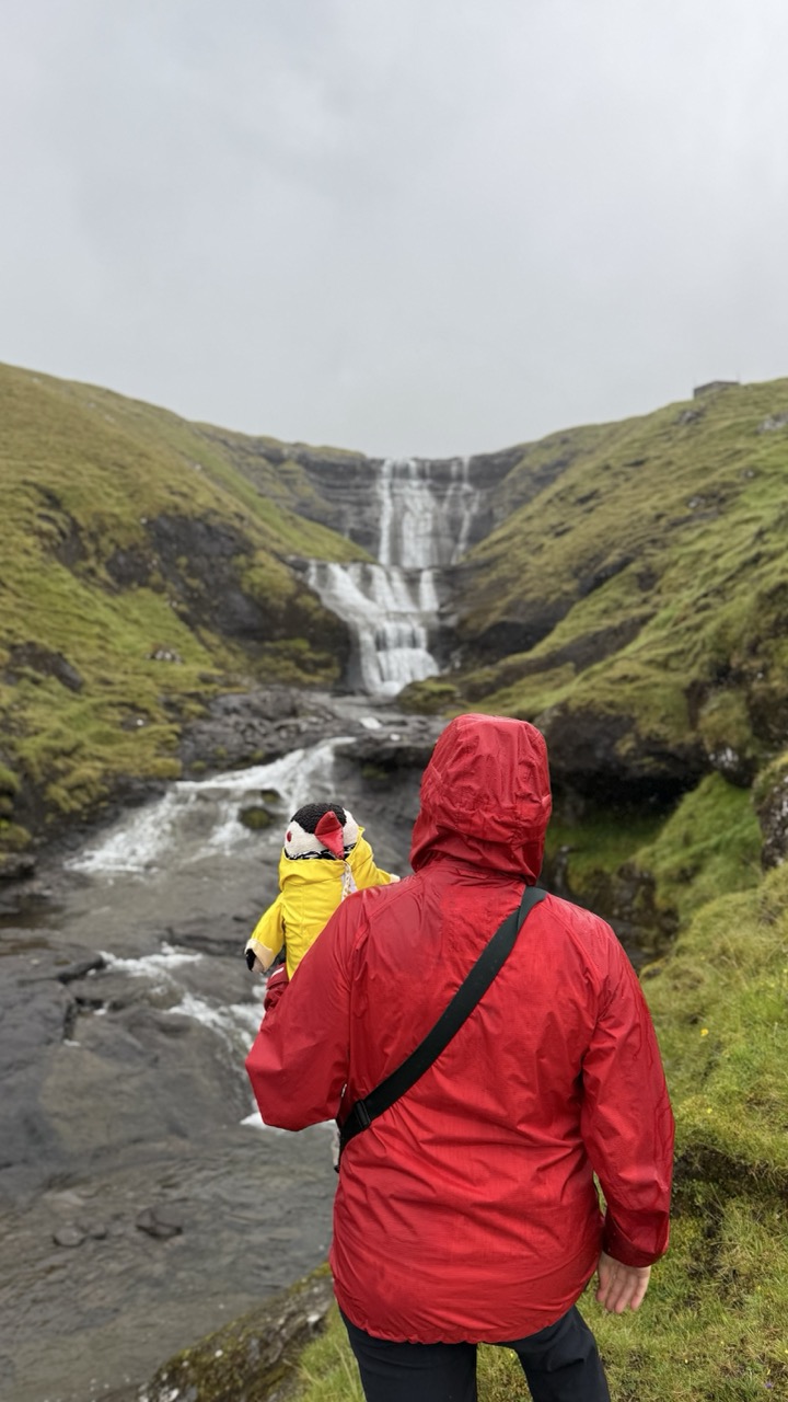
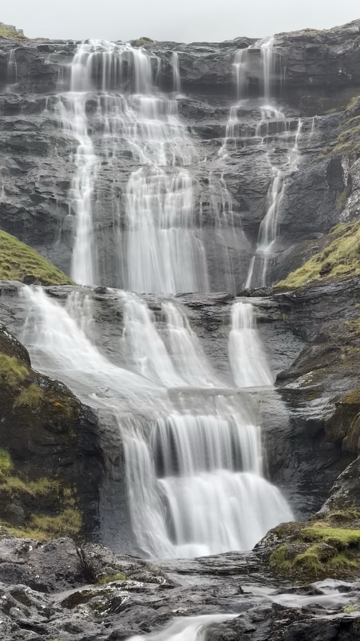
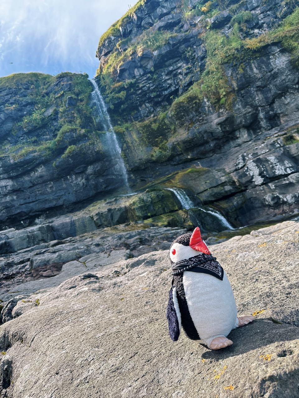
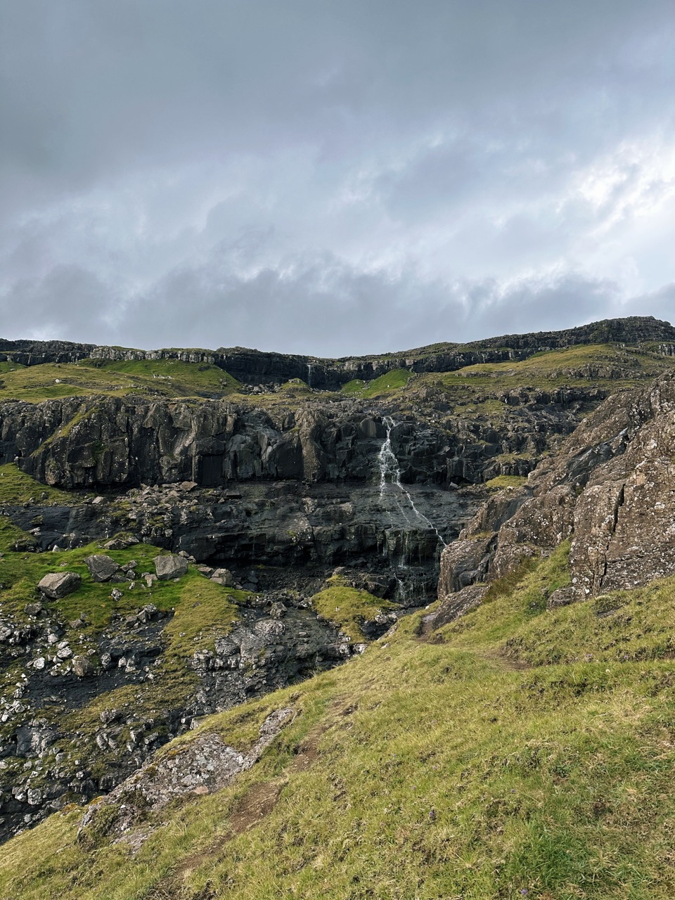
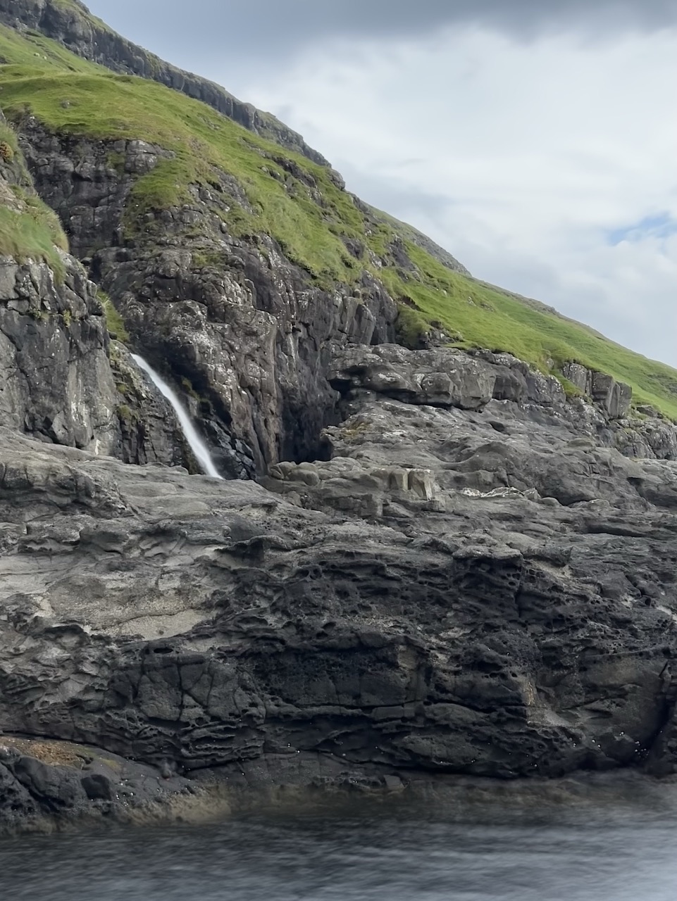
We saw so many waterfalls across the Faroe Islands, and some may even look more beautiful or dramatic, but we knew we wanted to visit the tallest one. Fossá holds that title, dropping in two stages on the northern side of Streymoy Island, just above the village of Haldórsvík. The water flows from the mountains near Víkartindur and plunges 140 metres down into the Sundini Strait. Standing close, you feel both its height and its force. We combined this stop with a visit to Tjørnuvík, which makes a perfect pairing for a day out in the north. We stopped at the waterfall after visiting Tjørnuvík.
Facts About Fossá Waterfall
- Height: ~ 140 metres (459 feet)
- Location: northern Streymoy, near Haldórsvík village (62.251117, -7.077642)
- Source water: mountain streams around Víkartindur and nearby peaks
- Name meaning: Fossá comes from Faroese, with “foss” meaning waterfall and “á” meaning river—together, “waterfall river”
- Best moments: after rain, when the flow strengthens and the spray reaches forward
How to get there and where to park
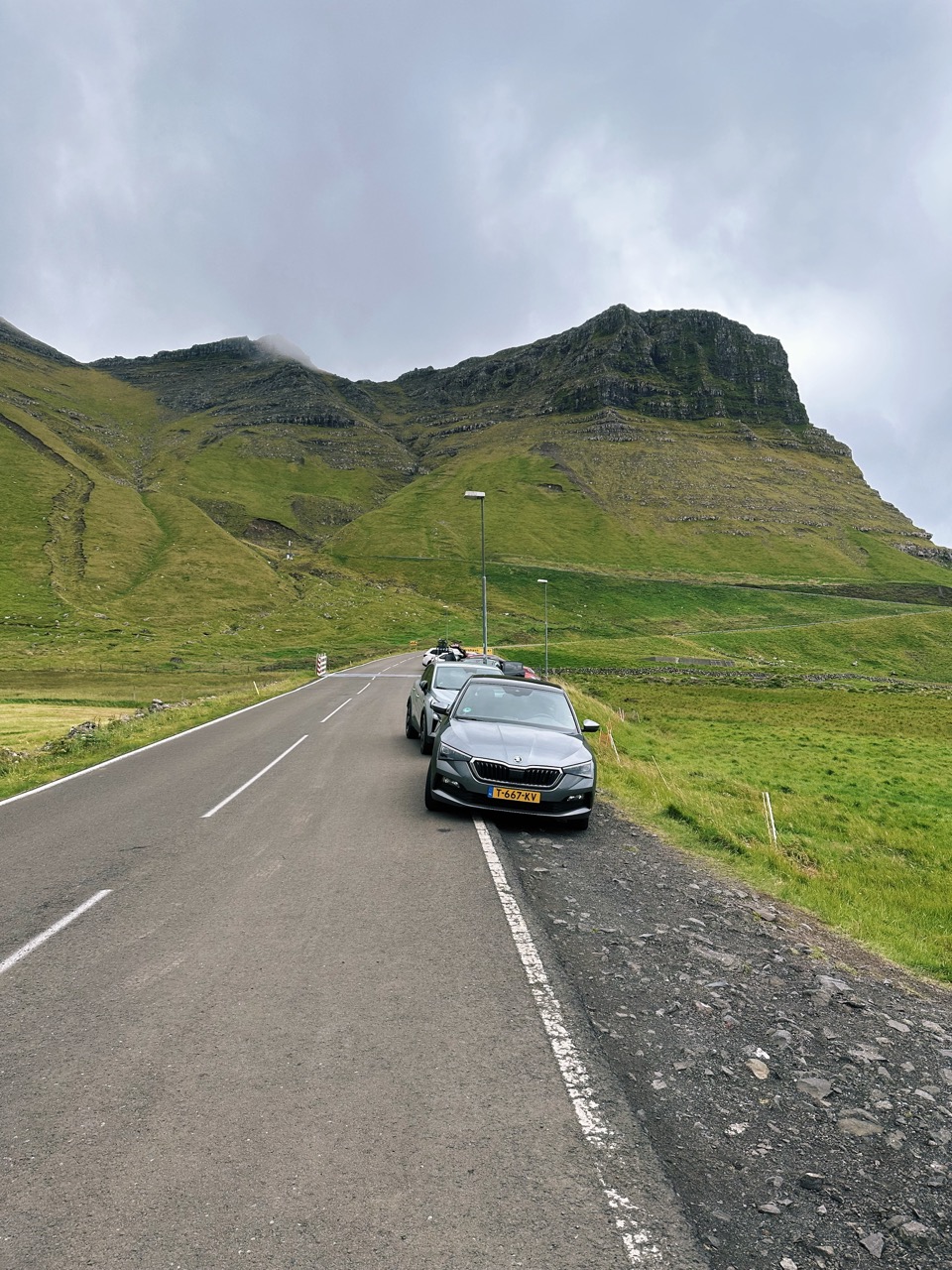
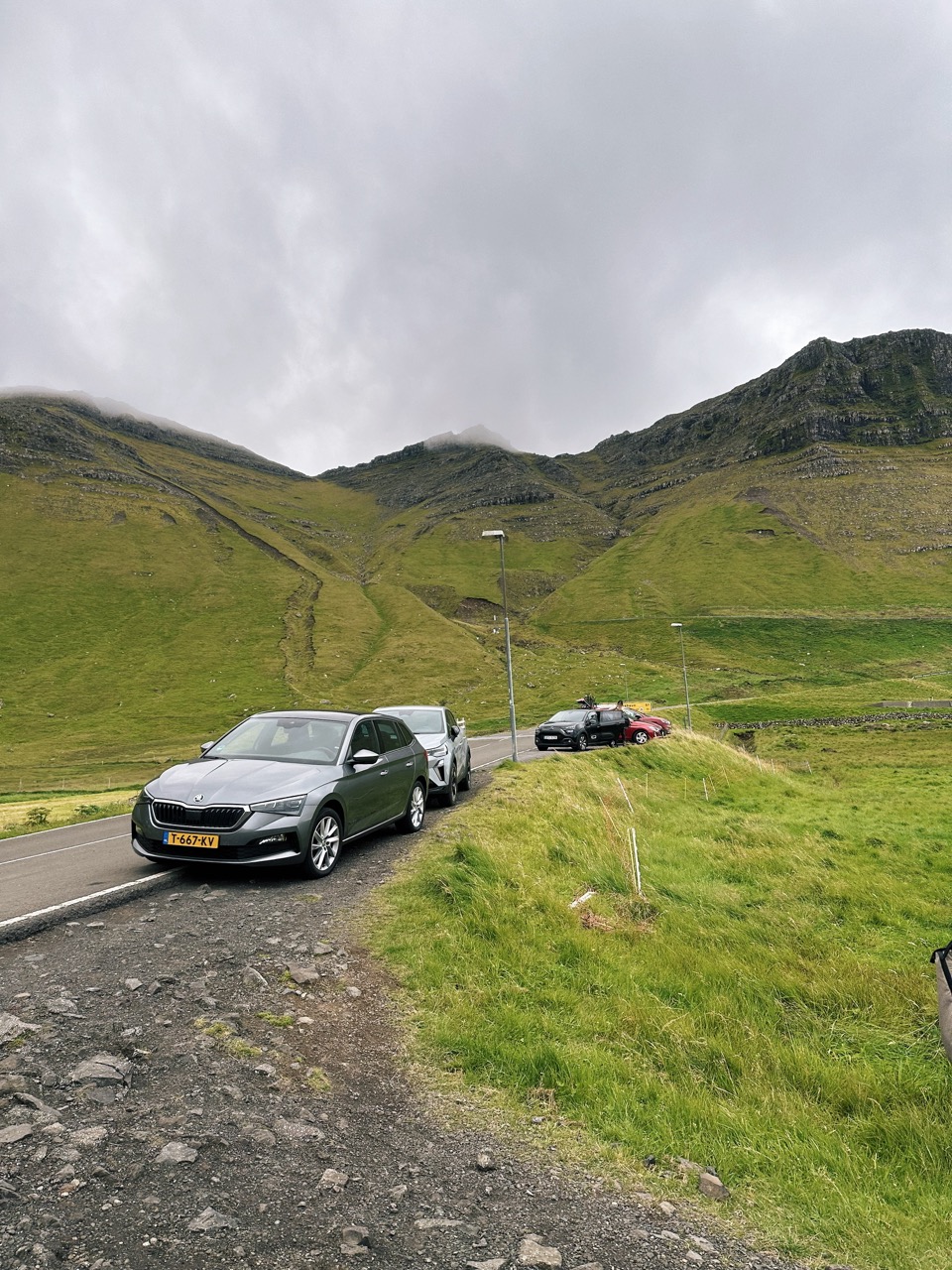
Drive from Tórshavn (the capital) toward the northern part of Streymoy. The waterfall sits east of Tórshavn, roughly 45 45-minute drive. Follow signs toward Haldórsvík, close to the Sundini Strait and near the bridge to Eysturoy.
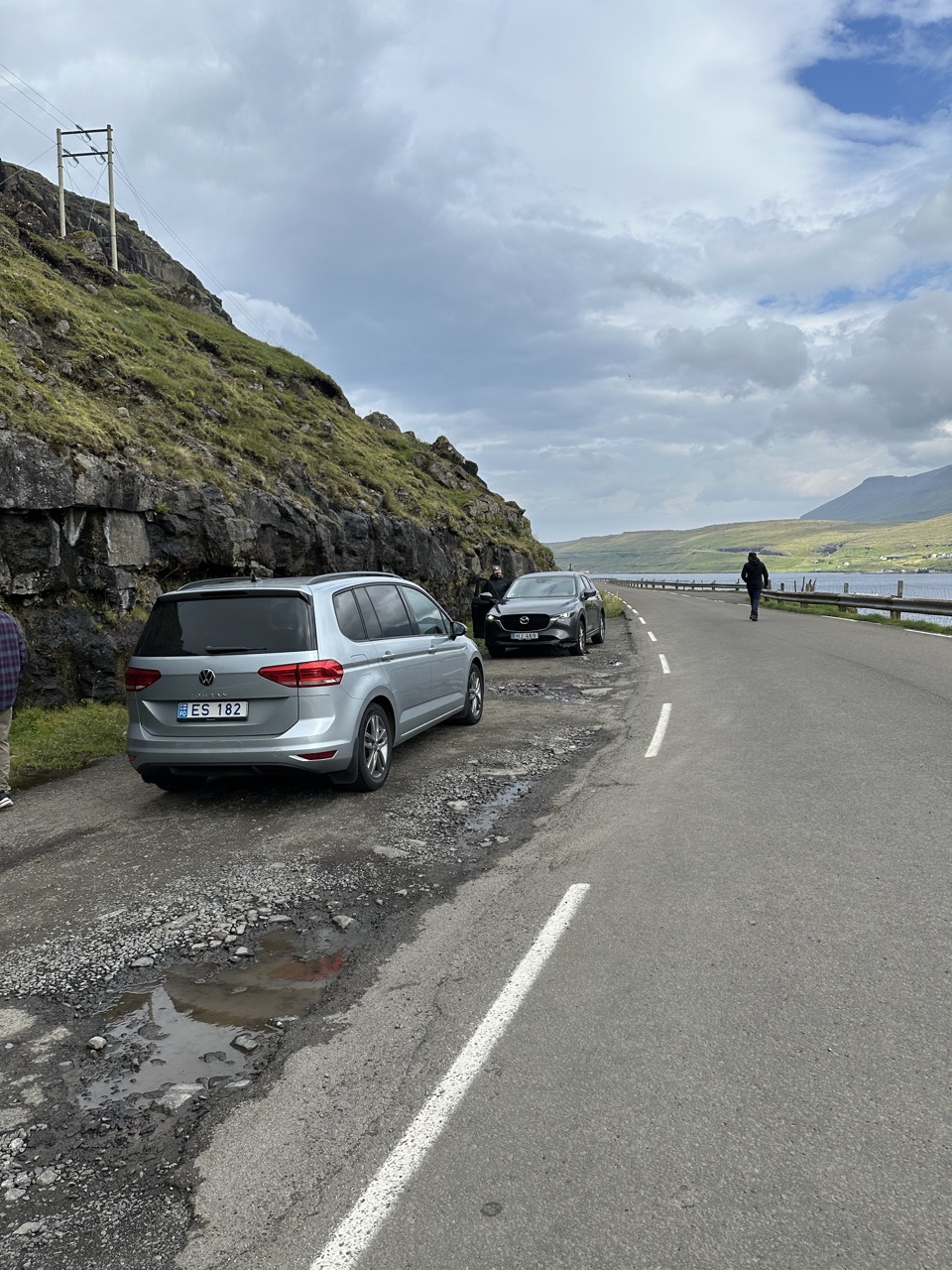
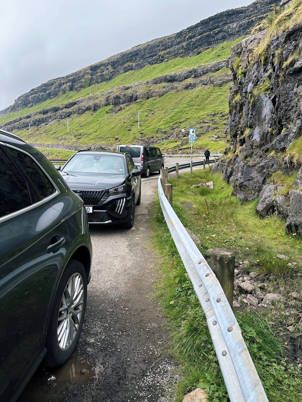
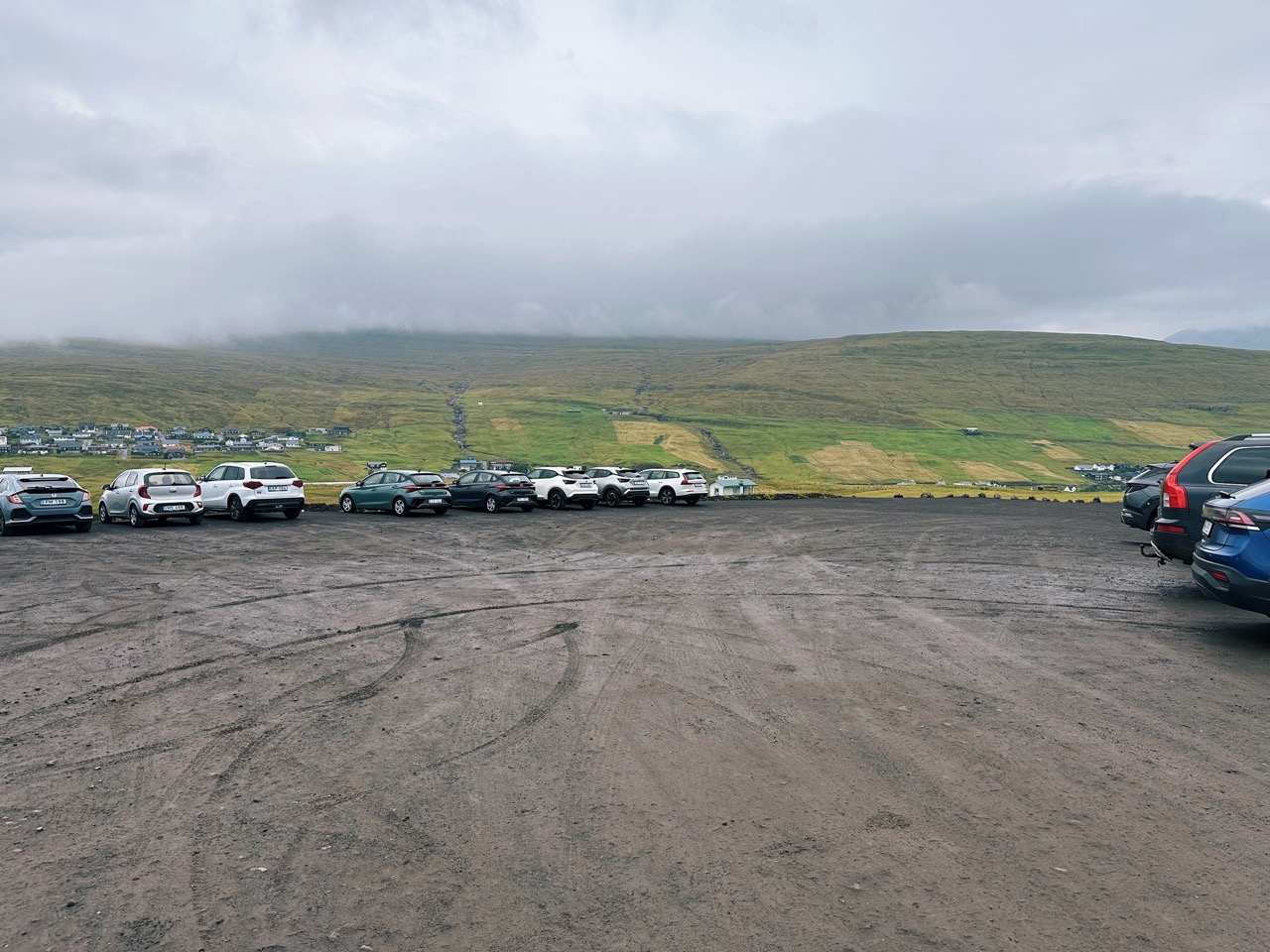
Where to park. Use one of the lay-bys beside the road near the waterfall. Each lay-by fits about eight cars. During July and August, these parking spots often fill up. If you find them full, drive a little farther and return; free spots usually become available.
Time needed
Allow yourself at least 1 to 1.5 hours from Tórshavn for the drive, stops, and time at the waterfall itself. Visiting the waterfall up close, enjoying the view, taking photos, and walking around takes approximately 30–45 minutes, depending on your pace and the extent of your exploration.
🐧 Penguin Pro Tip
If you want more than the roadside view, you can waddle up to the first part of Fossá. The path is not marked, but you can scramble along the rocks beside the stream and reach the plateau where the upper drop begins. From here, the perspective changes—you look down toward the Sundini Strait with the water rushing right past your feet. It’s a short but steep climb, so wear solid shoes and be mindful of slippery stones, especially after rain.
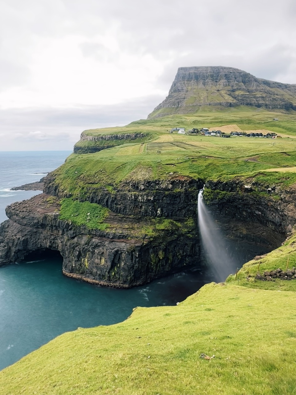
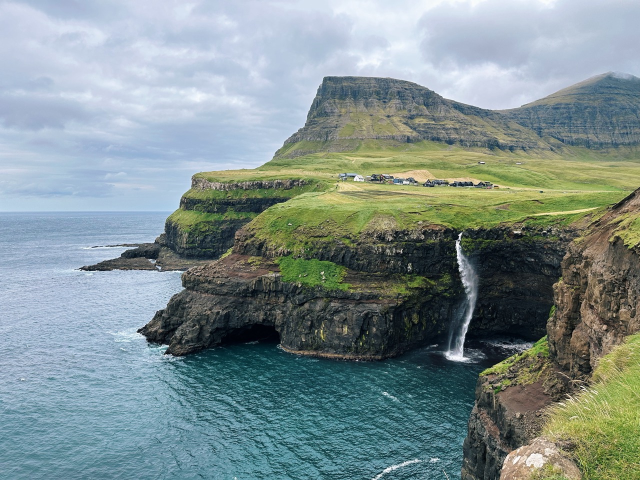
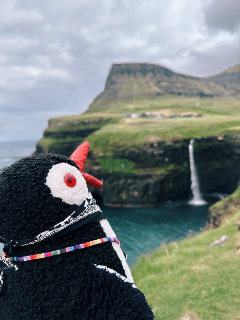
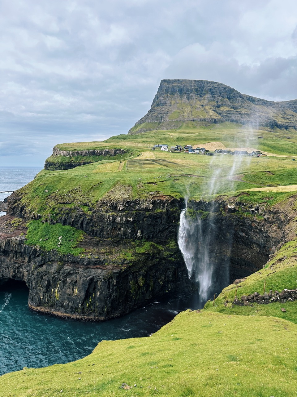
Múlafossur Waterfall
When we think about waterfalls in the Faroe Islands, Múlafossur is the one that comes to mind first. This is also likely because it’s one of the first images you see when searching online for the Faroe Islands. This is the famous cascade in Gásadalur, where the water drops straight into the ocean with sea cliffs and mountains in the backdrop. For years, the village of Gásadalur was only accessible by footpath or boat, making it a rare experience to see the waterfall. Today, a tunnel makes the drive easy, and you can stand at the viewpoint with one of the most iconic scenes in the Faroes right in front of you.
Facts About Múlafossur Waterfall
- Height: ~ 60 metres (197 feet)
- Location: Gásadalur village, Vágar Island (62.107589, -7.435555)
- Source water: a stream flowing from the surrounding mountains
- Name meaning: Múlafossur combines “Múla,” referring to the mountain above the village, with “fossur,” meaning waterfall
- Best moments: late afternoon or evening light, when the sun sets behind Mykines
How to get there and where to park
Drive from Vágar Airport toward Gásadalur. The road passes through a tunnel before reaching the village. The drive from the airport takes about 15 minutes, and from Tórshavn about 1 hour.
Where to park. A small parking area sits near the viewpoint in Gásadalur. From there, it’s only a short walk to the best vantage points. Parking is free, but space is limited, especially in summer. Read more about our experience at Múlafossur Waterfall: Faroe Islands’ Icon.
Time needed
Plan for around 30–45 minutes to enjoy the waterfall, take photos, and wander around the viewpoint. If you also explore the village or stop for coffee at the local café, allow up to 1.5 hours.
🐧 Penguin Pro Tip
The main viewpoint is stunning, but for a different angle, follow the small path past the houses and down toward the cliffs. You won’t get closer to the drop itself, but you find unique perspectives with the village and mountains framing the waterfall. Bring layers, since the wind can shift quickly here.
Bøsdalafossur Waterfall
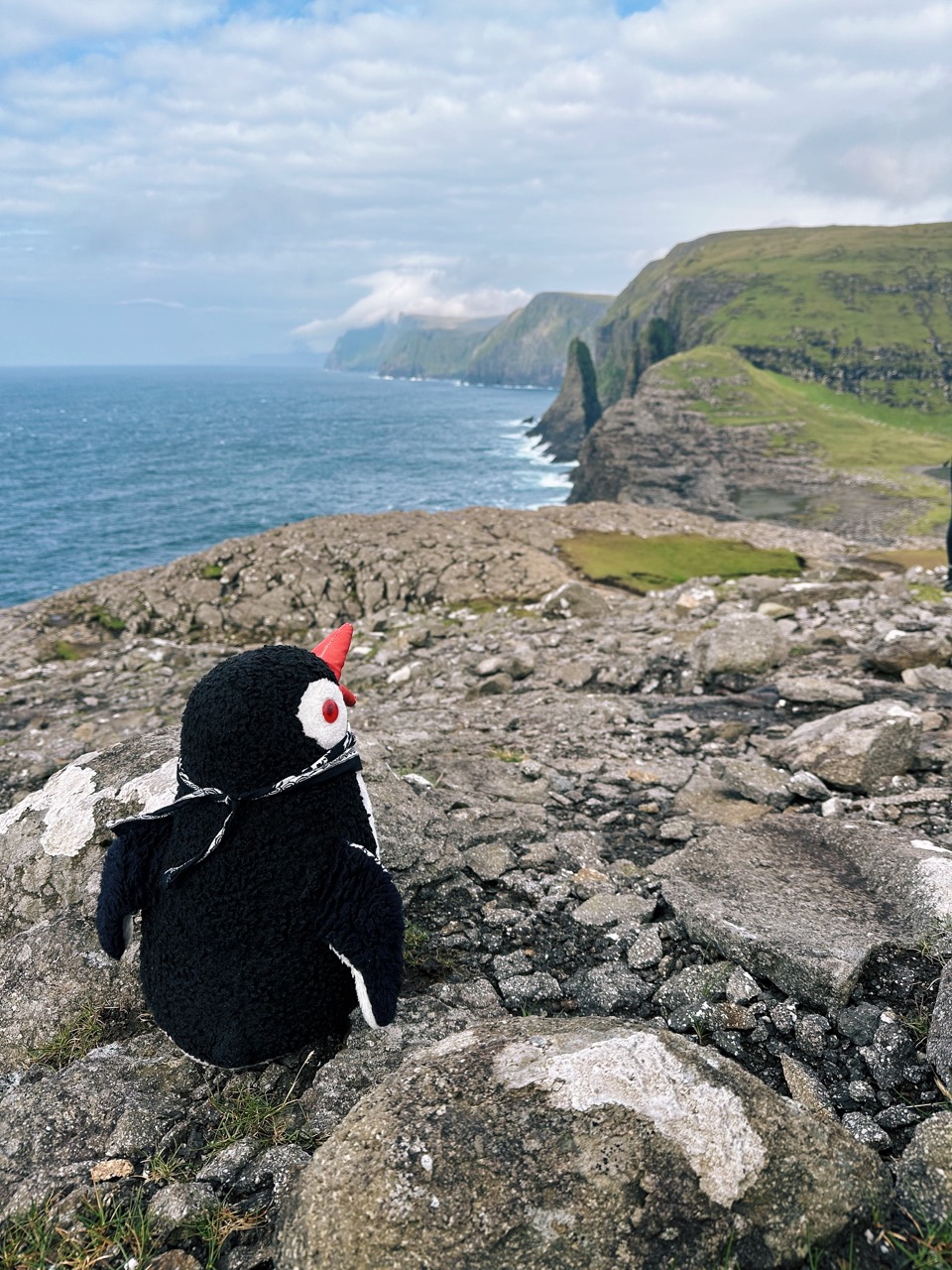
Bøsdalafossur stands out from other Faroese waterfalls due to its unique location. Instead of tumbling from a mountain stream, it flows directly out of Lake Sørvágsvatn, the largest lake in the Faroe Islands, and spills into the Atlantic Ocean below. For us, this was our first hike on our first day in the Faroe Islands, and reaching the waterfall felt like the perfect introduction. Standing there, watching fresh water meet salt water with cliffs stretching out toward the horizon, we understood why this hike gets paired with the famous “lake above the ocean” view. It set the tone for the rest of our journey.
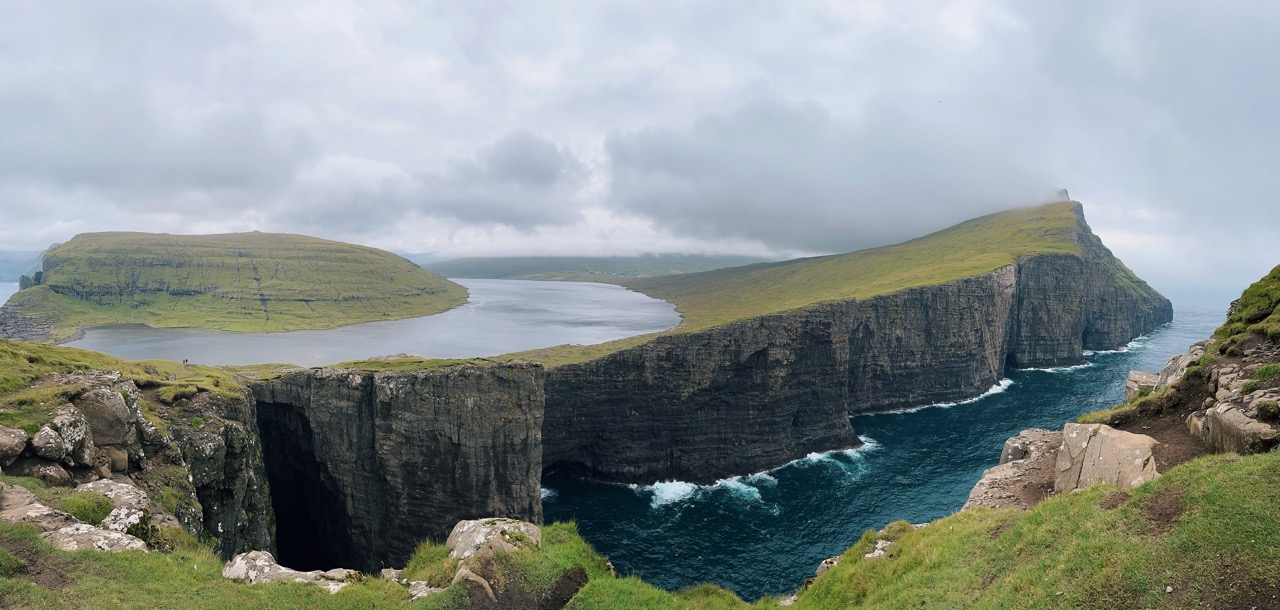
Facts About Bøsdalafossur Waterfall
- Height: ~ 30 metres (98 feet)
- Location: southern end of Lake Sørvágsvatn, Vágar Island (62.024054, -7.236708)
- Source water: Lake Sørvágsvatn (Leitisvatn)
- Name meaning: Bøsdalafossur takes its name from “Bøsdalur,” the valley nearby, combined with “fossur,” meaning waterfall
- Best moments: when waves crash against the cliffs below, adding to the drama
How to get there and where to park
Start from the parking area near Sørvágsvatn, at the trailhead for the hike often referred to as the “Trælanípan hike.” From Tórshavn, the drive takes approximately 45 minutes; from Vágar Airport, it is only about 15 minutes.
Where to park. A designated parking lot is available at the trailhead. Parking is available for a fee as part of the hiking access ticket, which you purchase before entering the trail. For more details, see our guide Bøsdalafossur Waterfall Hiking Guide: Where the Lake Meets the Sea.

Time needed
The hike to Bøsdalafossur takes about 1 hour each way, depending on pace, with time to enjoy the lake and the cliffs along the route. Plan for at least 3 hours total for the round trip, photos, and a break at the viewpoint.
🐧 Penguin Pro Tip
You can also combine the day with a visit to the Nix statue, which adds a touch of Faroese legend to the experience. Bring water and a windproof layer; the cliffs are exposed, and gusts can be intense.
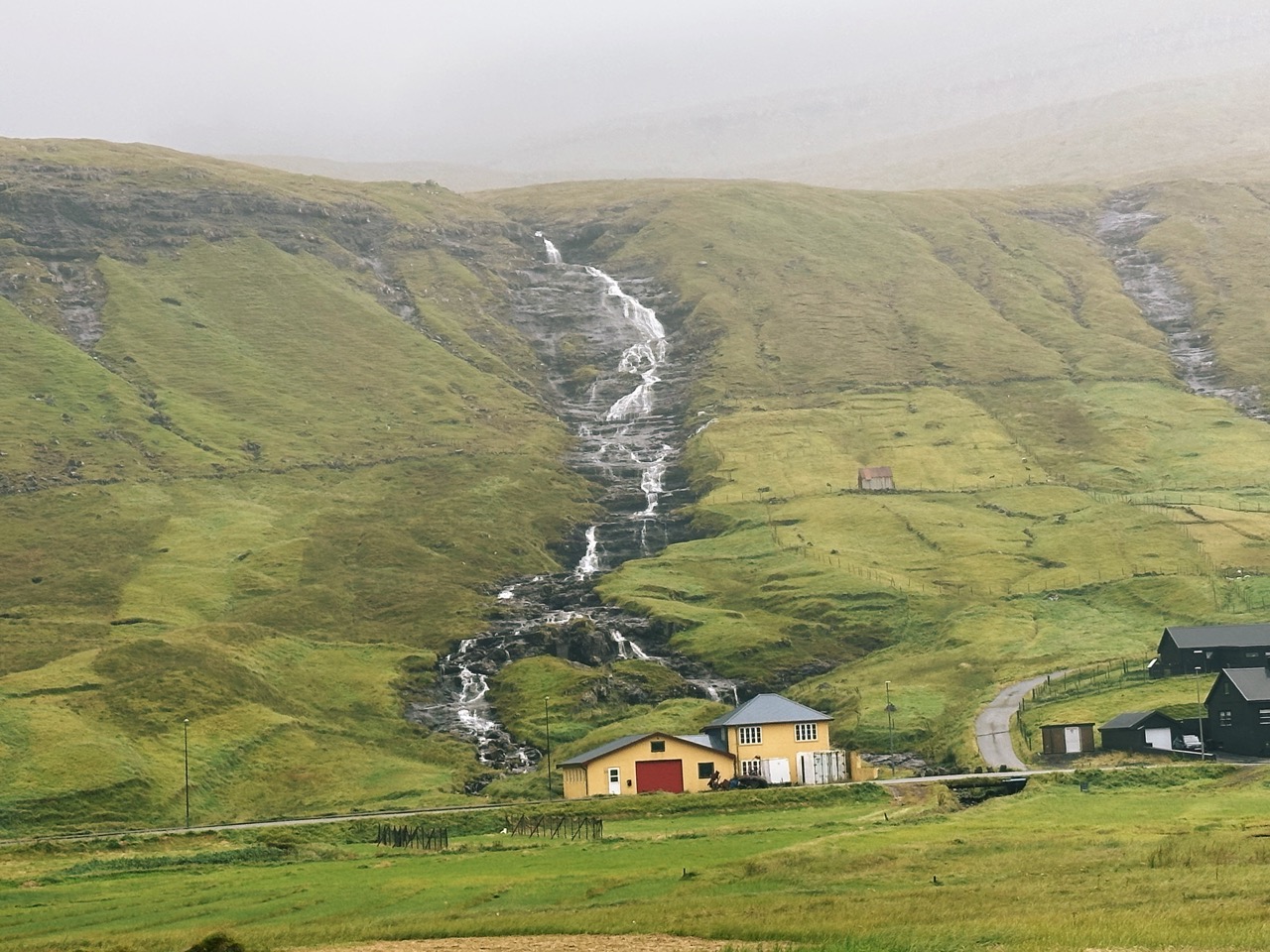
Hósvík Waterfall
Hósvík is a small village on the east coast of Streymoy, and many only pass through on their way north. For us, it became a short but memorable stop on our way back from the Eiðiskollur hike. The stream runs right through the village and drops into the fjord, framed by mountains on both sides. It may not stand as tall as Fossá or draw crowds like Múlafossur, but seeing a waterfall flow past houses and fields gave us a glimpse of everyday Faroese life and a quiet moment to pause before continuing the drive.
Facts About Hósvík Waterfall
- Height: relatively small but visible directly from the village
- Location: Hósvík village, Streymoy Island (62.149477, -6.943950)
- Source water: local stream flowing from surrounding hills
- Name meaning: Hósvík means “bay of the houses” in Faroese
- Best moments: on rainy days, when the flow strengthens and the village feels alive with rushing water
How to get there and where to park
Drive about 30 minutes from Tórshavn north toward Streymoy. Hósvík sits along the main road that connects the capital with the northern villages. You’ll see the waterfall as you enter the town.
Where to park. Parking is available in the village itself. You can leave your car near the local church, then take a short waddle to the stream and falls.
Time needed
A stop here takes no more than 15–20 minutes, unless you decide to stroll around the village or enjoy the harbor views.
🐧 Penguin Pro Tip
Pair Hósvík with other stops in the area, such as Hvalvík and the wooden church in Saksun, for a relaxed drive along Streymoy’s east coast. It makes a nice contrast to the bigger waterfalls while giving you time to stretch your legs in a small Faroese village.
Waterfalls Everywhere You Drive
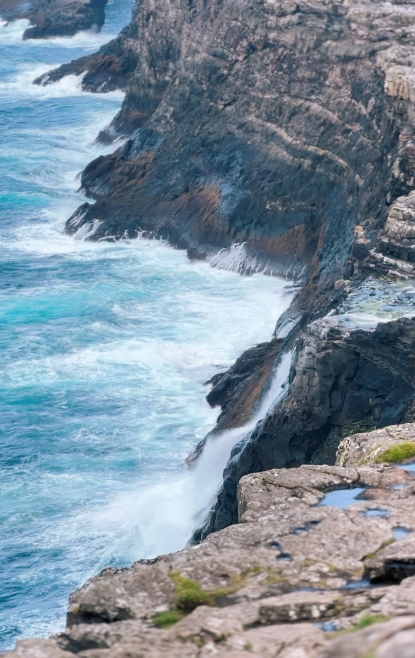
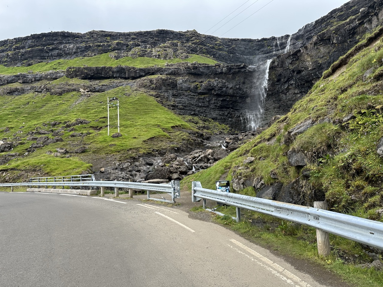
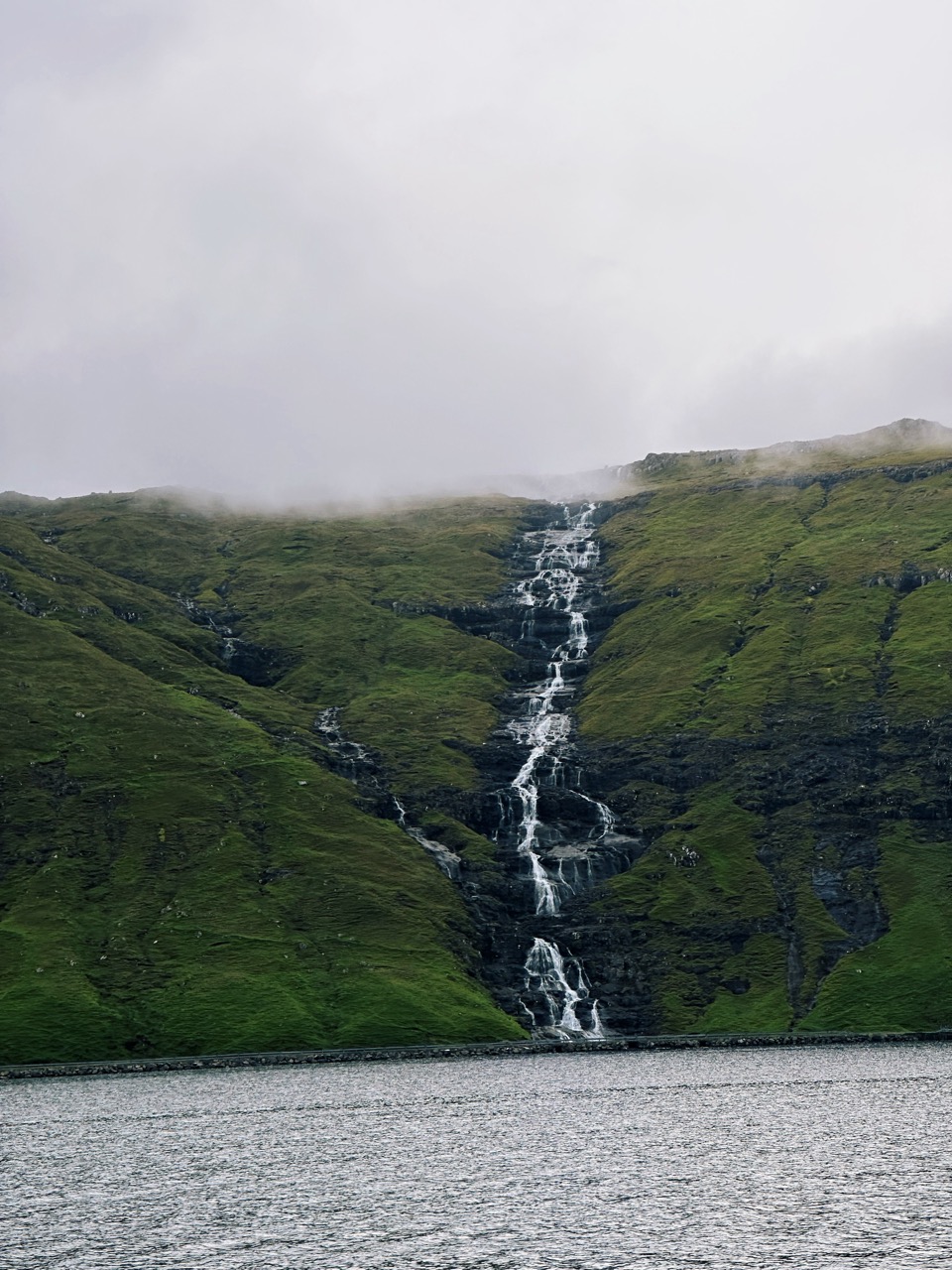
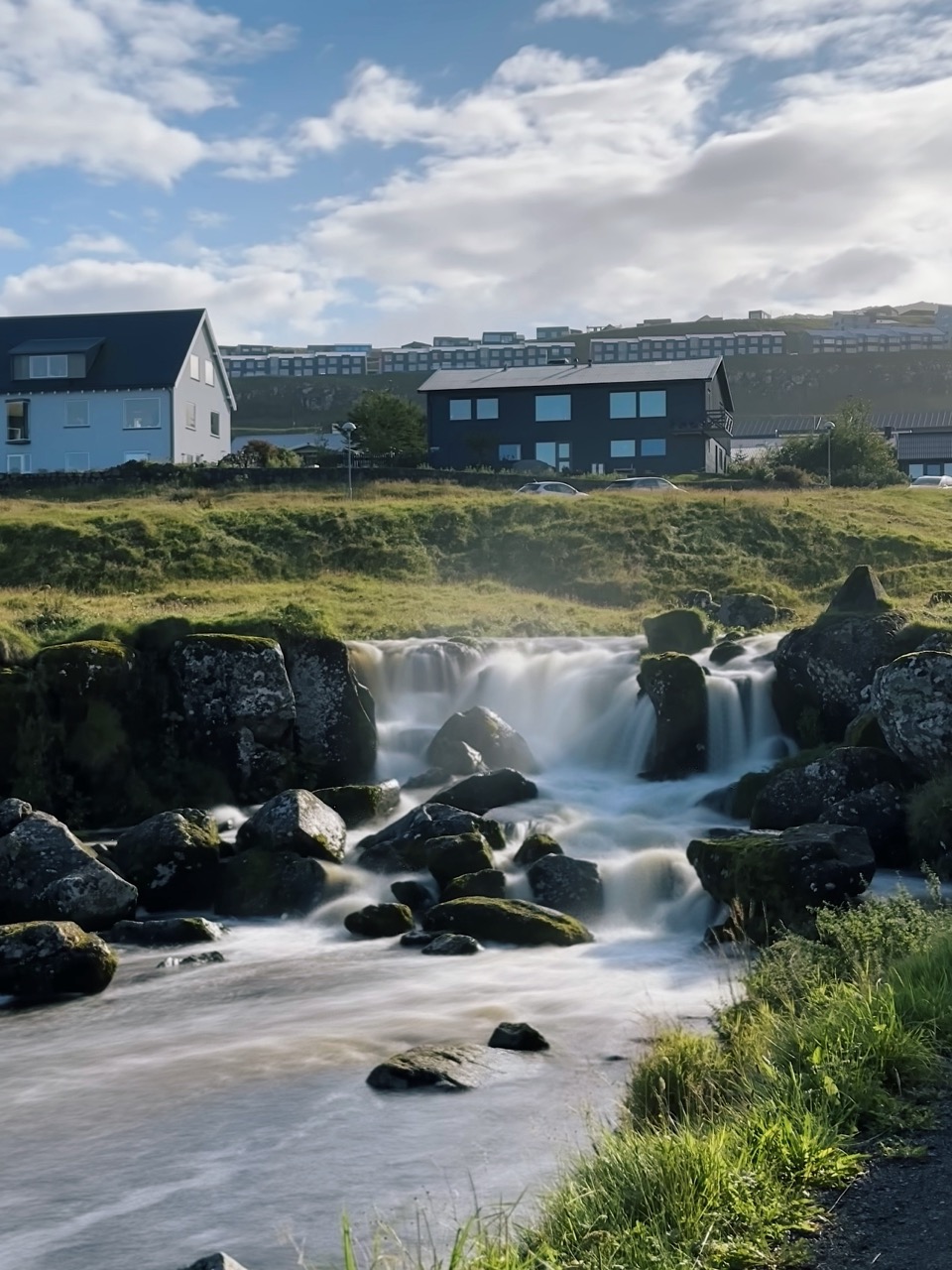
One of the things that strikes you in the Faroe Islands is how many waterfalls appear without warning. With over 40 named waterfalls and countless unnamed streams, you often see water tumbling down cliffs right from the car window. On Kalsoy, we found streams rushing down the mountainside near Mikladalur, and on other drives, we found ourselves pulling over for waterfalls that never make it into guidebooks. These spontaneous sights become part of the Faroese experience; you don’t just plan visits to famous falls, you discover dozens more as you drive through valleys, along fjords, and over mountain roads. And that’s what we loved, as it made many unexpected stops to enjoy nature.
Whether it’s the iconic Múlafossur, the towering Fossá, or the countless smaller streams you pass on winding drives, waterfalls define the Faroese landscape. Each one feels alive, shifting with rain, mist, and light. Our time chasing waterfalls here became one of the most rewarding parts of the trip, and if you’re planning your own journey, make sure to leave space in your itinerary for both the famous stops and the surprises waiting around every bend.
Pack your bags, put on waterproof gear, and enjoy the waterfalls of the Faroe Islands.

This post contains affiliate links. If you click and buy, I might earn a tiny commission, enough to help a penguin keep up its globe-trotting lifestyle. No extra cost to you, just more fish for me. Thank you for supporting the adventure!